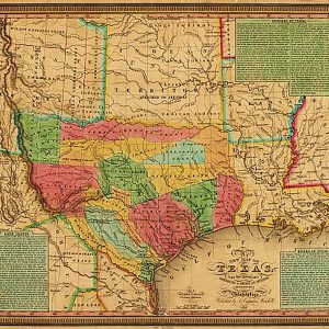
This striking map produced just before Texas declared it s independence from Mexico shows colonies and land grants, the Neuces River as the border between Texas and Mexican states, Indian Territory attached to Arkansas, Santa Fe area, towns, rivers, and roads. The three text boxes discuss at some length the land grant system (Land Grants),…
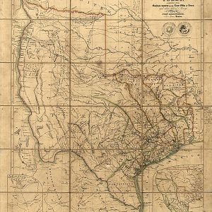
This fascinating map published during the period of The Republic by the London firm of John Arrowsmith is quite literaly covered with hand written notes (see detail link below) by an Englishman named Wm. Bollaert who had come to Texas at the behest of his friend William Kennedy who was subsequently appointed British consul at…
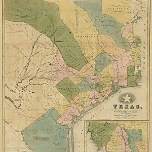
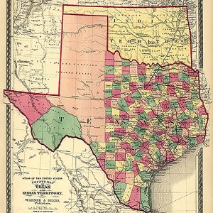
What sets this map by Frank Gray apart from the others of this period are the seven inset maps that show: the rivers of Texas and their tributaries, a “Hypsometric Sketch of Texas” that depicts the topography, Galveston, Galveston Bay, Matagorda Bay, Austin, and the southern tip of Texas. This beautiful reproduction is printed on…
This is a colorful and easy-to-read map featuring topography in shaded relief. Beautiful as well as functional, this map will brighten any office or study. Features include: Index of counties & larger towns and cities Simple distance chart population data Vibrant colors This map is rolled and shipped in a sturdy cardboard tube.
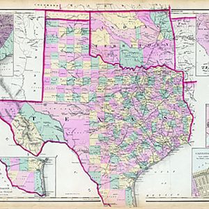
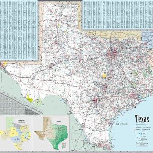
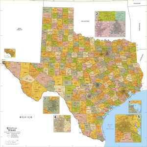
This wall map of Texas, shows counties, towns, cities, villages, major roads and highways. Includes community index and inset maps of Houston, DFW and the Austin San Antonio metro area. This map is rolled and shipped in a sturdy cardboard tube.
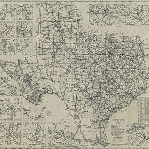
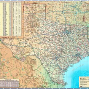
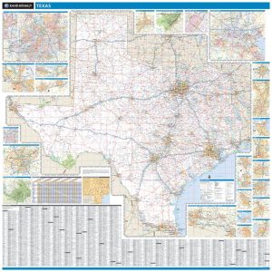
This extremely popular map includes all state, US and Interstate highways, cities & towns, airports, elevations, rivers, lakes, parks and county names and boundaries. Also included are inset maps of telephone area codes, statewide elevation contours and a mileage chart. This map is rolled and shipped in a sturdy cardboard tube.
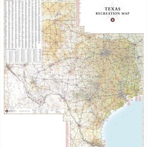
Texas has a reputation for big country, big cities, and Big Bend National Park. This wall map illustrates the vast countryside and recreation attractions throughout The Lone Star State, from Gulf Coast and fields of Blue Bonnets in the east to the panhandle’s Palo Duro Canyon and the Guadalupe Mountains in the west. If outdoor…
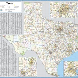
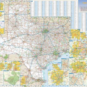
This colorful, easy-to-read state map of Texas identifies all major thoroughfares, secondary roads, freeway interchanges, rest areas, distance markers, landmarks, recreational areas, and more. Shaded relief on the state map provides a three-dimensional sense of Texas topography. Detailed city inset maps of Abilene, Amarillo, Austin, Beaumont, Corpus Christi, Dallas Fort Worth, El Paso, Houston Galveston,…
Laminated with Hanging Rails 60 W x 60 H Index of Counties and Cities Fully Indexed Counties, Cities, Mileage Chart Inset Maps of All Major Cities Free Shipping! This map is rolled and shipped in a sturdy cardboard tube.
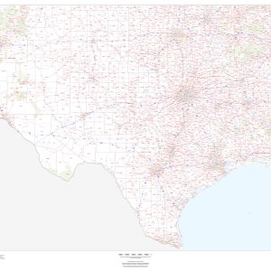
This map of Texas shows ZIP codes overlaid on a road map. Base map features include county boundaries, major road network features, and state and national parks and conservation areas. This map is rolled and shipped in a sturdy cardboard tube.
This map has been created and designed for business or reference use. Clear and clean colors & fonts matched with cartographic research makes this Texas Zip Code Map with Counties easily readable and useful. The map shows the 254 counties of Texas and the borders of the over 1,900 zip codes across the Lone Star…
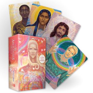
Tap into the powerful, supportive force of the Archangels with this 22-card oracle from best-selling author, card deck creator, and angel expert Kyle Gray. The Archangels are a divine legion of angels who have been charged by the light of God to serve, protect, heal, and guide humanity towards wholeness. These divine Angels create a…
As our national fabric unravels before a watching world, the unanswered question of the twenty-first century cries for a response: What happened to the America that once led the world by example? To put it bluntly, we have forgotten the covenant that our Founders made with our Creator. Its very meaning has been canceled by…